

Beyond the postcard views and sun loungers, another Gran Canaria awaits you. A wilder one. A quieter one. A more mysterious one.
If you've ever looked beyond the horizon and wondered what lies behind the tourist curtain of this island, then this guide is for you.
Forget the all-inclusive pools and crowded beaches for a moment. Let's venture deep into the ancient lungs of the island, where laurel trees whisper ancient secrets and volcanic peaks prop up the sky like guardians of another time.
Here are five magical places that will make you fall in love with the real Gran Canaria – the Gran Canaria that needs no filters or fanfare to leave you speechless.
La Selva de Doramas – The enchanted forest of the north
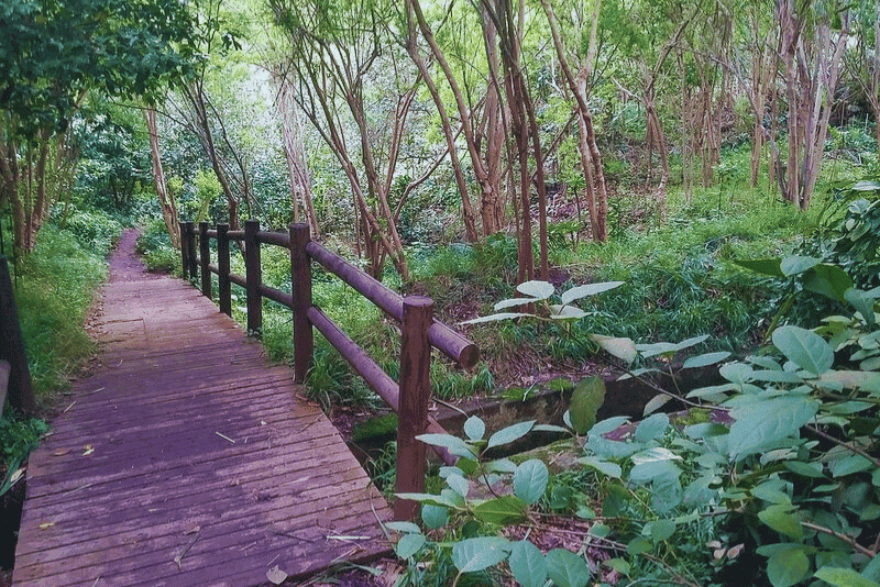
Somewhere in the misty north of Gran Canaria, there is a forest where time passes more slowly and the air smells of moss, laurel and damp earth. Welcome to La Selva de Doramas, a living testament to the pre-Spanish soul of the island.
Your journey begins near the Centro de Interpretación de Los Tilos in Moya. From here, a path winds gently into a world of towering trees – many over 20 metres tall – such as the mythical tilos, endemic laurel trees and other species found only in the Canary Islands.
Every step is a return to nature.
Every breath tastes of chlorophyll and silence.
And if you're lucky, you'll hear nothing but birdsong and the wind rustling through the leaves.
This is a place where children imagine fairies behind ferns, where families picnic on ancient stones, and where hikers rediscover their sense of wonder.
Pro tip: wear shoes that can get dirty, bring a thermos of hot tea, and take your time. This isn't a hike – it's a dialogue with nature.
Useful Information: La Selva de Doramas
| ???? Location | Centro de Interpretación de Los Tilos de Moya – Google Maps |
| ???? Trail | Easy loop – approx. 2.5 km |
| ???? Access | Car (free parking near visitor center) |
| ☀️ Best time | Early morning / cloudy days |
| ???? Tip | Bring picnic – there are stone tables in the woods |
| ⚠️ Notes | Paths can be slippery after rain. Not suitable for strollers. |
Barranco de los Cernícalos – The gorge where the water whispers
Let us now head east, towards Telde.
Here there is a ravine that lies hidden like a secret between sun-scorched hills and volcanic slopes. Its name? Barranco de los Cernícalos, or "The Ravine of the Kestrels".
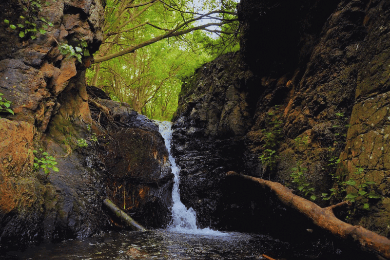
This is not a typical dry island ravine. It is alive. Lush. Cool. And above all, it has water. Real water. Running water. Whispering. Life-giving.
Start your hike in Lomo Magullo and follow the stream that nestles along the left bank. The path takes you past small waterfalls, shady nooks and ponds so clear that you'll be tempted to dip your toes in.
Eventually, the path climbs up to the source, becoming more rugged and surrounded by a canopy of native vegetation and the occasional kestrel circling above. It's like walking through a hidden corridor between two worlds: the dry and the fertile, the familiar and the wild.
Note: this is a 12 km circular walk, so plan accordingly. Take water, snacks and preferably a guide if you are unfamiliar with longer trails. But don't worry – what awaits you at the end is worth every step.
Useful Information: Barranco de los Cernícalos
| ???? Location | Start at Lomo Magullo – Google Maps |
| ???? Trail | 12 km roundtrip – moderate |
| ???? Access | Car to start point – some unpaved sections |
| ☀️ Best time | November to March – more water flow |
| ???? Tip | Waterproof hiking boots, snacks, and at least 1.5L water |
| ⚠️ Notes | No facilities on the trail. Navigation can be tricky – go with a guide if unsure. |
El Charco Azul – The blue pool of forgotten dreams
There are places that feel as if they were just waiting for you.
El Charco Azul is one of them.
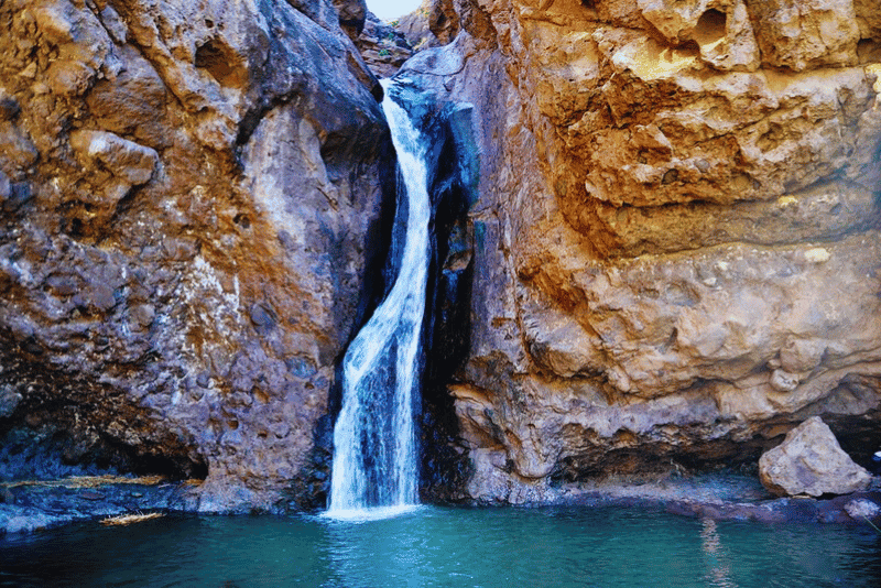
Hidden in the rugged landscape near Agaete in the north-west of Gran Canaria, this crystal-clear pool lies at the end of a short but impressive hiking trail. The trail itself is a gentle start – it winds its way through tall grass, rushing valleys and the echoes of silence that only nature can compose.
But it is the destination that leaves a lasting impression:
a small lagoon fed by a delicate waterfall, surrounded by rocks smoothed by centuries of rain and wind.
Come between October and January – the island's rainy season – and you can experience the full symphony of cascading water and emerald green foliage.
If you're lucky, the pool will be full. Cold. Inviting. Irresistible.
And when you dive into the icy, clear waters of Charco Azul, it's like putting everything that's unimportant on pause.
This is not a tourist spot. It's a sacred respite. A baptism by nature. A place where you can remember who you are.
Useful Information: El Charco Azul
| ???? Location | Barranco de El Risco (Agaete) – Google Maps |
| ???? Trail | 3 km total – easy/moderate |
| ???? Access | Car to El Risco village, then short walk |
| ☀️ Best time | October to January (rainy season) |
| ???? Tip | Bring towel & bathing suit – the water is cold but refreshing |
| ⚠️ Notes | Check water levels before going – dry in summer |
El Pinar de Tamadaba – A temple made of trees
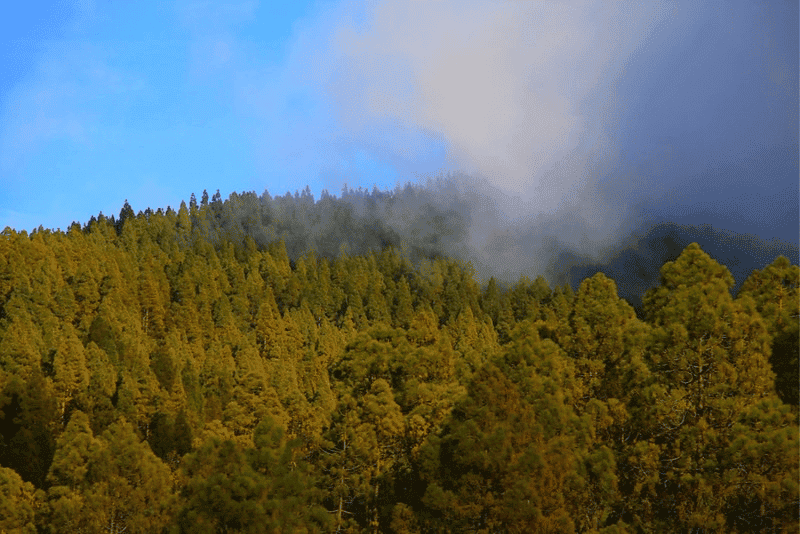
On the western heights of Gran Canaria, a forest unlike any other rises up – vast, tranquil and sacred.
El Pinar de Tamadaba is a sanctuary of ancient pines and volcanic soil, high enough to touch the clouds.
Here, the silence has depth.
The kind of silence that lets you hear your own heartbeat.
Begin your journey near Roque Nublo, the island's legendary stone monolith. From the nearby picnic areas, hiking trails lead up into a pine-scented dreamscape where every step crunches softly under your boots and sunlight filters through a thousand green needles.
Climb high enough – up to 1,440 metres above sea level – and you'll witness a phenomenon called "the sea of clouds". Imagine standing above the island while everything below you is covered by a thick layer of white fog that stretches like a frozen ocean to the Atlantic.
Es ist die Art von Aussicht, die Ihnen die Worte raubt und sie durch Ehrfurcht ersetzt.
Kommen Sie hierher, um sich zu verlieren. Kommen Sie hierher, um zu heilen. Kommen Sie hierher, um sich daran zu erinnern, dass die Natur kein WLAN braucht, um Sie zu verbinden.
Useful Information: Pinar de Tamadaba
| ???? Location | Area Recreativa Tamadaba – Google Maps |
| ???? Trail | Variable – several trails up to 10 km |
| ???? Access | Paved road to recreation area (beware of fog) |
| ☀️ Best time | All year – especially spring and autumn |
| ???? Tip | Best chance to see “Mar de Nubes” is early morning |
| ⚠️ Notes | High altitude – bring warm layers. No phone signal in some parts. |
Güi-Güi Beach – Where the earth meets eternity
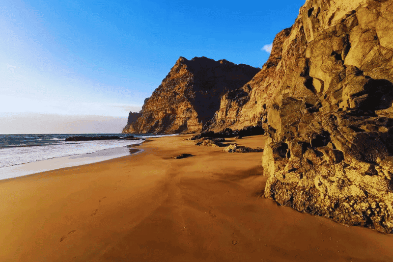
If there were a holy grail on the island for people seeking solitude, this would be it.
Güi-Güi Beach (pronounced "wee-wee") is not just a destination – it is a place of pilgrimage.
There are only two ways to get there:
By boat from Puerto de Mogán (often referred to as the "Little Venice" of Gran Canaria)
Or on foot, after a 1.5-hour hike that starts in Tasartico, a remote village surrounded by surreal volcanic mountains and valleys shaped by wind and time.
The hike is challenging, especially under the midday sun, but every drop of sweat is rewarded once you reach your destination:
A wild, untouched black sand beach flanked by steep cliffs and lapped by turquoise waves.
There are no bars, no music, no vendors here.
Only wind.
Only silence.
Just the rhythm of the Atlantic and the shadows of birds above you.
This is where you come when you want to escape the world and feel the raw presence of the earth beneath your feet.
Bring nothing. Expect nothing. And you will leave with everything.
Useful Information: Playa de Güi-Güi
| ???? Location | Trailhead in Tasartico – Google Maps |
| ???? Trail | 4.5 km one way (9 km roundtrip) – moderate to hard |
| ???? Access | Dirt road to Tasartico – drive carefully |
| ☀️ Best time | Spring or autumn (avoid midday heat) |
| ????️ Tip | Bring food, hat, and 2L+ water – no services at the beach |
| ⚠️ Notes | No shade, no signal, no rescue service. Only for experienced hikers unless you go by boat. |
Bonus tips from a local adventurer (that's Sven)
- Respect the landscape. Many of these places are sensitive ecosystems. Leave no trace.
- Travel light, but travel wisely. Always carry water, a charged mobile phone and a basic first aid kit.
- Ask the locals. Some trails change depending on rain, wind or closures.
- Don't rush. Gran Canaria rewards slowness. Let the pace of the island guide you.
Final Words: The Island Within the Island
The beauty of Gran Canaria lies not only in its beaches or sunsets. It lies in these hidden retreats, where you realise that something ancient still lives in the rocks, in the forests, in the silence.
These five places are just the beginning.
They are not for everyone – and that is precisely the point.
But if you have made it this far… perhaps you are not just a visitor.
Perhaps, just perhaps, you are someone who has been called here – to feel something real, to breathe deeply and to find a part of yourself in the wilderness of this island.
If that appeals to you, let me show you more.
I've been exploring Gran Canaria for 20 years – on foot, by bike, following my instincts.
And if you ever feel the urge to live this island life and not just taste it…
I know exactly where you need to start.